Trekking on the Etruscan Coast: the most beautiful trails
6 min · 29 May 2023

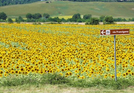
The Etruscan Coast is not only crystal-clear sea, enchanting beaches and suggestive villages, but also one of the most popular destinations for hiking and trekking enthusiasts. There are, in fact, a large number of cart tracks and splendid paths, more or less long and more or less frequented, that reveal landscapes of extraordinary beauty. These paths, which for centuries have accompanied woodcutters, charcoal burners, millers, poets and shepherds, will let you discover the wilder side of the Costa degli Etruschi.
What are the most beautiful trekking routes on the Costa degli Etruschi? Let’s discover them together.
Calafuria Nature Reserve
Located a few kilometres from Livorno, the Calafuria Nature Reserve stretches for about 115 hectares between the coast and the immediate hinterland. The path inside the reserve is undoubtedly the one that offers the most impressive view of the coast. It starts at Fosso, near the Torre del Boccale (on the coast of Calafuria). Beyond the reserve entrance gate, take the dirt road known as Via Dorsale. Continue as far as a widening where the road forks: Via del Telegrafo is indicated on the right, while the route continues to the left as far as the Semaforo del Montaccio, from where it is possible to enjoy a magnificent view of the entire Costa degli Etruschi. Following the dirt road, you reach the highest point of the itinerary (about 300 metres above sea level) and from there the small village of Castellaccio, where there are several refreshment points. At this point, we turn back along the road we have already travelled as far as the widening, where we leave Via Dorsale to continue straight on towards Via del Telegrafo. When you reach Piazzale dei Colombi, turn right onto Via dell’Esbosco. Shortly after Via dell’Esbosco, it joins Via degli Allori and continues in the same direction until it joins Via Dorsale, where it picks up the road taken at the beginning of the route.
Degree of difficulty medium-easy. Duration 2½ hours.
Sterpaia Coastal Park
In the wide gulf between Piombino and Follonica lies the enchanting Sterpaia Coastal Park, a must-see for anyone visiting the Etruscan Coast. The protected area covers an area of over 300 hectares. The itinerary in the park is of great environmental and landscape interest. The starting point is the La Sterpaia (or Carlappiano) car park. You leave the car park by taking the asphalt road and turning right. After about 200 metres, turn right again onto the dirt road. Before a large eucalyptus tree, we turn right onto a small road, at the end of which we cross a bridge over the Fosso Cervia and turn left, still on a dirt road following the canal. After 200 metres, the small road bends right and, after another 200 metres, we come to a crossroads where we again keep to the right. At the next fork, go right again onto the small road. Shortly afterwards you come to a picnic area with various facilities. Past the picnic area, the road bends to the right: after a short distance, take the first left and continue to an area with various picnic areas, where you turn right to return to the starting point.
Degree of difficulty easy. Duration 4 hours.
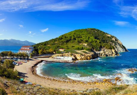
Promontory of Piombino
The Piombino Promontory corresponds to the stretch of coast north of the town of Piombino, between Punta Falcone and the beautiful Gulf of Baratti. The itinerary starts from the Cala Moresca car park (Salivoli locality). It proceeds for about 1 kilometre on a dirt road that gradually narrows to a path that continues halfway up the coast. Shortly after the beginning of the path, you come to a fork on the left that descends to Spiaggia Lunga. Continue for another kilometre and there is another fork on the left: the path slopes steeply down to the Fosso alle Canne beach. Shortly after, at Punta della Galera, the itinerary climbs towards the promontory, moving away from the coast. The path then becomes a wider track until it reaches the ridge road near the ruins of the Monastery of San Quirico. From the church, continue along the ridge road in a southerly direction up the slopes of Monte Pecorino and then proceed towards Poggio Grosso and Monte Massoncello. The road reaches Campo alla Sughera, where it descends towards the Ghiaccioni district. Still descending, you reach the Cala Moresca car park.
Degree of difficulty medium. Duration 5 hours.
Park of Poggio Neri
The Poggio Neri Park extends over 600 hectares to the east of the town of Sassetta and offers countless recreational opportunities for those who enjoy outdoor activities. The itinerary we suggest here starts from the parking area of the La Cerreta farm. Descend to the dirt road that climbs towards the Casetta Fiorentina knoll: the climb ends after 900 metres near a picnic area. Proceed downhill on the left for a little more than a kilometre to a crossroads at Podere I Colli: the road bends to the right, descending for 400 metres and climbing up the hill (where you take route No. 1). Continue by turning left towards Podere La Pieve and then descending for 3.5 kilometres to the Lodano river plain. After passing the high-tension cable line, continue until you reach the Sant’Anna artificial lake. You skirt the lake and then the stream. Past a clearing, continue into the forest and at the next two clearings, keep to the side of the river. After a short while, you come to a fork in the path: follow the signs indicating route no. 1 on the left. After ascending for 1.3 kilometres, we descend towards Podere I Colli and reach the next crossroads, where we turn right and take the path that descends towards Pian delle Vigne. When you come to an old bridge, turn left and continue towards Podere Livorno and the next crossroads, where you continue on the
Degree of difficulty medium. Duration 4 hours.